Corona Municipal Airport (KAJO) – Pilot Resources
Local Time: Friday, March 13th, 2026 11:19 am (PDT)
UTC Time: March 13th, 2026 (UTC) – 1819Z
Current Weather:
VFR METAR KAJO 131556Z AUTO 00000KT 10SM CLR 17/09 A3003 RMK AO2 SLP163 T01670089
TAF KONT 131120Z 1312/1418 VRB04KT P6SM SKC FM132100 25010KT P6SM SCT250 FM140400 VRB04KT P6SM SCT250
AWOS Phone Number: Click to Reveal
Pleasants Peak Webcam (~7 Miles South of KAJO, Showing the Airport Vicinity, Facing North):
Night:
The Corona Municipal Airport (KAJO) is a non-towered primary GA airport in Corona, California, elevation 533′ MSL, with a single 3,200′ x 60′ asphalt runway 07/25 (calm-wind runway 25). Expect a busy mix of GA fixed-wing traffic, with frequent helicopter operations, mostly flight training, and monitor/announce intentions on CTAF/UNICOM 122.7. Also expect IFR traffic arriving from the northeast from Paradise (PDZ), circling to land Runway 25 from midfield.
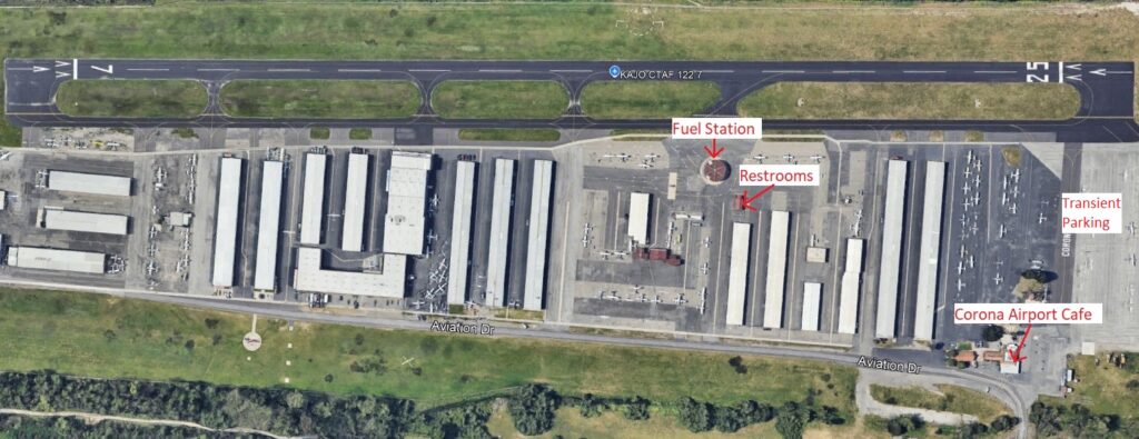
1900 Aviation Dr, Corona, CA 92878
Businesses and Organizations:
Civil Air Patrol (Corona Cadet Squadron 29)
Aircraft Spruce West (shuttle service offered)
VFR Chart (Click to Open)

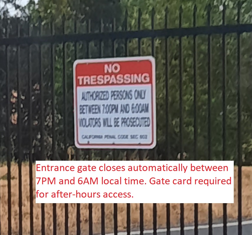
Not For Navigation; use only official FAA sources.