Prado Reservoir Water Levels
Current Reported Elevation: 501.7‘ MSL (73.7% until Flood Alert)
Current Threat Level: Medium
Corona Municipal Airport (KAJO) - Reported Water Levels
See official data HERE from the US Army Corps of Engineers (USACE) – Water Management Data
Interim Water Control Manual – Prado Dam & Reservoir
Threat Levels Explained
Low
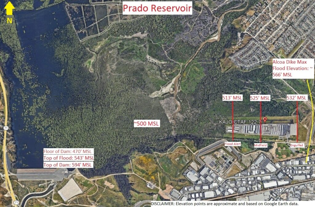
- Water level is >= 470‘ MSL (Dam’s floor level), and < next threat level
- Normal conditions; no risk of flooding at the airport based on current water levels.
Medium
- Water level is >= 480‘ MSL, and < next threat level
- Percent filled >= 50%
- Slightly elevated monitoring; flooding is not expected, but tenants may want to keep an eye on potential rising levels.
High
- Water level is >= 506‘ MSL, and < next threat level
- Percent filled >= 85%
- Heightened concern; increased risk of flooding in low areas, and tenants should consider plans to move assets if levels continue to rise.
Flood Alert
- Water level is >= 513‘ MSL (approx. elevation at RWY 7 threshold), and < next threat level
- Percent filled >= 100%
- Airport flood-alert level; water has theoretically reached the pavement and threshold for RWY 7 (west side). Floodwater may begin to impact further parts of the usable runway and other low spots on the field.
Midfield
- Water level is >= 525‘ MSL, and < next threat level
- Percent filled >= 128%
- Significant flooding; approximately half of the usable runway and infield areas are theoretically flooded.
Engulfed
- Water level is >= 532‘ MSL, and < next threat level
- Percent filled >= 144%
- Severe flooding; theoretically, most or all paved surfaces (runways, taxiways, ramps) are expected to be flooded.
Percent filled is calculated using the ratio of the current reservoir water level to the depth between the dam’s floor (470‘ MSL) and the Flood Alert (513‘ MSL), a range of ~43 feet.
Because the runway and airport surface are upslope to the east, values above 100% indicate that water has progressively flooded farther up the runway and airport surface area.
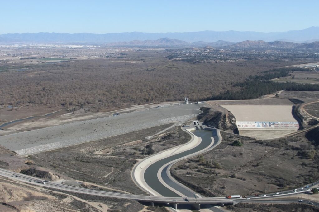
Prado Dam is an earth-fill flood-control dam on the Santa Ana River just west of Corona, California. Built in the early 1940s by the U.S. Army Corps of Engineers, it creates the Prado Reservoir and flood basin, which can temporarily store runoff from the upper Santa Ana River watershed. The main purpose is to reduce flood risk for the densely developed communities downstream along the river, especially in Orange County.
The Prado flood basin is the low-lying land behind the dam that can be intentionally inundated during storms. In normal conditions it supports wetlands, wildlife habitat, and groundwater recharge projects, but during major winter storms it acts as a large safety buffer, holding back water so it can be released downstream in a controlled way.
Along the north and east side of the basin, the Alcoa Dike is a high earthen levee and flood-protection feature built as part of the larger Santa Ana River Mainstem Project. It is designed to keep high reservoir levels from spilling toward nearby neighborhoods, roads, and businesses in Corona, and to provide protection for floods on the order of a “190-year” event (a very large storm with roughly a 0.5% chance of occurring in any given year).
The Corona Municipal Airport (KAJO) sits inside this Prado flood basin on relatively low ground. Because of that location, parts of the airport have been flooded in recent decades during periods of heavy rainfall, when rising reservoir levels spread across the basin floor—one of the reasons why airport tenants should monitor the Prado water levels.
You can view the official data feed from the USACE that our website uses to monitor the water levels HERE
Disclaimer: Prado water-level information on this site is provided for general awareness only. Values are based on third-party sensor data and automated processing and may be delayed, incomplete, or inaccurate. Our “flood alert” levels and thresholds are arbitrarily defined for informational purposes, are not official warning levels, and may not match government criteria, although we strive to keep them reasonable and up to date. Corona Pilots Association (CPA) is not affiliated with the U.S. Army Corps of Engineers or any other government agency and is not responsible or liable for any actions taken, or not taken, based on this information. Airport tenants and occupants are solely responsible for their own safety decisions and should use their own judgment and any official information or guidance that may be available.